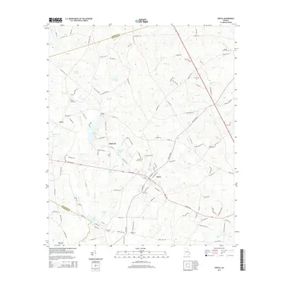
2014 Map of Portal
USGS Topo · Published 2014About this map
Portal serves as the primary junction for rural life in Bulloch County, where modern transit corridors like Us 25 and W Highway 80 intersect a landscape shaped by the tributaries of Lotts Cr. This 2014 survey reveals a dense network of family and community landmarks, particularly evident in the high concentration of small burial grounds such as Mincey Cem and Munlin Cem. Smaller settlements like Piddleville and Aaron appear tucked between managed water bodies including Oglesby Pond Dam and Lanier Pond. The terrain is defined by its drainages, with Panther Br, Mill Cr, and Big Br creating the natural boundaries between agricultural tracts and wooded lots. The map offers a clear view of the area's social geography, anchoring rural neighborhoods around sites like Banks Creek Church Cem and Poplar Springs Cem.
Find a feature on this map
121 named features on this map. Tap any name to fly to it.
Don’t see what you’re looking for? This feature index may not catch every label — zoom into the map to look around manually.
Map Details
Editions of this 2014 Portal Map
This is the sole edition of this map. No revisions or reprints were ever made.
Other maps of this area

1920 · Statesboro
USGS Topo · 1:62,500

1921 · Rocky Ford
USGS Topo · 1:62,500

1943 · Rocky Ford
USGS Topo · 1:62,500

1943 · Millen
USGS Topo · 1:125,000

1943 · Statesboro
USGS Topo · 1:62,500

1947 · Savannah
USGS Topo · 1:250,000

1948 · Savannah
USGS Topo · 1:250,000

1957 · Macon
USGS Topo · 1:250,000

1957 · Savannah
USGS Topo · 1:250,000

1958 · Macon
USGS Topo · 1:250,000