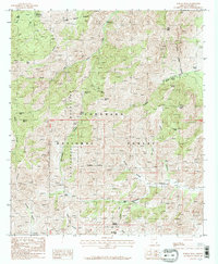
1987 Map of Portal Peak
USGS Topo · Published 1987About this map
The Chiricahua Mountains dominate this landscape within the Coronado National Forest, where high-elevation landmarks like Portal Peak and Sulphur Peak rise above a network of deep drainages. In the late 1980s, the area served as a significant recreational and wilderness corridor, featuring the Herb Martyr Campground and South Fork Campground near the perennial waters of South Fork Cave Creek.
Find a feature on this map
41 named features on this map. Tap any name to fly to it.
Don’t see what you’re looking for? This feature index may not catch every label — zoom into the map to look around manually.
Map Details
Editions of this 1987 Portal Peak Map
2 editions found
Other maps of this area

1917 · Chiricahua
USGS Topo · 1:125,000

1919 · Chiricahua
USGS Topo · 1:125,000

1926 · Rodeo
USGS Topo · 1:62,500

1926 · Rucker
USGS Topo · 1:62,500

1926 · Pedregosa
USGS Topo · 1:62,500

1940 · Apache
USGS Topo · 1:62,500

1955 · Douglas
USGS Topo · 1:250,000

1958 · Chiricahua Peak
USGS Topo · 1:62,500

1958 · Apache
USGS Topo · 1:62,500
1958 · Pedregosa Mountains
USGS Topo · 1:62,500