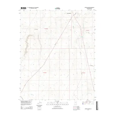
2014 Map of Porter Canyon
USGS Topo · Published 2014About this map
Porter Canyon defines the upper elevations of this Navajo County landscape, located just south of the town of Holbrook. The 2014 survey documents a transition from the structured township grid into the open drainage basins of the high desert. Modern infrastructure like Code Talkers Dr and Az-377 intersects with older routes such as Old Holbrook Rd, showing the evolution of regional transit. Water management is a primary feature of this arid terrain, with the Five Mile Reservoir and Heber Road Tank positioned to capture seasonal runoff. These features, along with Fivemile Wash and Washboard Wash, illustrate the hydrological patterns that have historically dictated land use and ranching boundaries in this part of Arizona.
Find a feature on this map
17 named features on this map. Tap any name to fly to it.
Don’t see what you’re looking for? This feature index may not catch every label — zoom into the map to look around manually.
Map Details
Editions of this 2014 Porter Canyon Map
This is the sole edition of this map. No revisions or reprints were ever made.
Other maps of this area

1886 · Holbrook
USGS Topo · 1:250,000

1893 · Holbrook
USGS Topo · 1:250,000

1954 · Holbrook
USGS Topo · 1:250,000

1955 · St. Joseph 1 NE
USGS Topo · 1:24,000

1955 · St. Joseph 2 SE
USGS Topo · 1:24,000

1955 · St. Joseph 1 SE
USGS Topo · 1:24,000

1955 · St. Joseph 1 NW
USGS Topo · 1:24,000
1955 · St. Joseph 2 NE
USGS Topo · 1:24,000

1955 · Joseph City
USGS Topo · 1:62,500
1955 · Holbrook
USGS Topo · 1:62,500