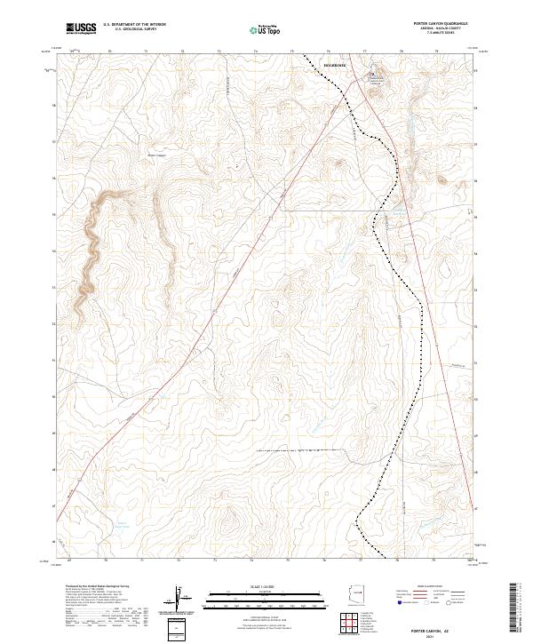
2021 Map of Porter Canyon
USGS Topo · Published 2021About this map
Holbrook sits at the northern edge of this high-desert plateau, where the Navajo County Superior Court - Holbrook serves as a key landmark in the local seat of government. The landscape is defined by its drainage systems and water management, with Fivemile Wash and Washboard Wash cutting through the terrain towards the north. Arid-land infrastructure is evident in the presence of the Five Mile Reservoir and the Heber Road Tank, which provide essential water resources for this section of Navajo County. The area south of the town center transitions into the deeper relief of Porter Canyon, while a network of rural routes like Heber Rd and Reidhead Ave connects the scattered developments and rangeland. This survey highlights the intersection of civic authority and the natural geography of the Little Colorado River valley region.
Find a feature on this map
16 named features on this map. Tap any name to fly to it.
Don’t see what you’re looking for? This feature index may not catch every label — zoom into the map to look around manually.
Map Details
Editions of this 2021 Porter Canyon Map
This is the sole edition of this map. No revisions or reprints were ever made.
Other maps of this area

1886 · Holbrook
USGS Topo · 1:250,000

1893 · Holbrook
USGS Topo · 1:250,000

1954 · Holbrook
USGS Topo · 1:250,000

1955 · St. Joseph 1 NE
USGS Topo · 1:24,000

1955 · St. Joseph 2 SE
USGS Topo · 1:24,000

1955 · St. Joseph 1 SE
USGS Topo · 1:24,000

1955 · St. Joseph 1 NW
USGS Topo · 1:24,000
1955 · St. Joseph 2 NE
USGS Topo · 1:24,000

1955 · Joseph City
USGS Topo · 1:62,500
1955 · Holbrook
USGS Topo · 1:62,500