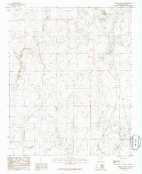
1986 Map of Porter Canyon
USGS Topo · Published 1986About this map
Porter Canyon and its complex network of seasonal drainages define this portion of the high desert in Navajo County. This mid-1980s U.S. Geological Survey provisional map illustrates a landscape primarily managed for resource extraction and water management. Evidence of industrial activity is scattered across the terrain, including an Oil Drill Hole, a Quarry, and a Gravel Pit. The map is also a record of communication and utility infrastructure, featuring a Radio Tower and a substantial Trans Line cutting through the quadrangle.
Find a feature on this map
17 named features on this map. Tap any name to fly to it.
Don’t see what you’re looking for? This feature index may not catch every label — zoom into the map to look around manually.
Map Details
Editions of this 1986 Porter Canyon Map
This is the sole edition of this map. No revisions or reprints were ever made.
Other maps of this area

1886 · Holbrook
USGS Topo · 1:250,000

1893 · Holbrook
USGS Topo · 1:250,000

1954 · Holbrook
USGS Topo · 1:250,000

1955 · St. Joseph 1 NE
USGS Topo · 1:24,000

1955 · St. Joseph 2 SE
USGS Topo · 1:24,000

1955 · St. Joseph 1 SE
USGS Topo · 1:24,000

1955 · St. Joseph 1 NW
USGS Topo · 1:24,000
1955 · St. Joseph 2 NE
USGS Topo · 1:24,000

1955 · Joseph City
USGS Topo · 1:62,500
1955 · Holbrook
USGS Topo · 1:62,500