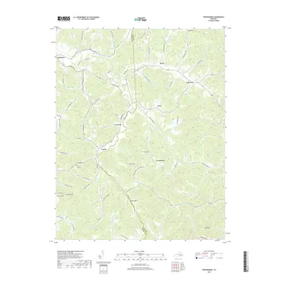
2019 Map of Portersburg
USGS Topo · Published 2019About this map
The South Fork Rockcastle River meanders through the central valley of this Clay County region, dividing the landscape between Laurel and Clay counties. Small upland settlements and post offices like Portersburg, Deer Lick, and McWhorter are connected by a network of winding ridge-top and creek-bottom roads, reflecting the traditional Appalachian settlement patterns of the area. The map identifies key community anchors for local historians, including New Bethel Ch, Salem Ch, and the Linck Cem located near Crawford. Significant topographical features such as High Knob and Cutoff Knob define the elevation changes, while numerous drainage branches like Buffalo Br and Alderson Br feed into the larger river system. Modern infrastructure is represented by the Hal Rogers Pky passing through the southern portion of the quadrangle.
Find a feature on this map
87 named features on this map. Tap any name to fly to it.
Don’t see what you’re looking for? This feature index may not catch every label — zoom into the map to look around manually.
Map Details
Editions of this 2019 Portersburg Map
This is the sole edition of this map. No revisions or reprints were ever made.
Other maps of this area

1891 · Manchester
USGS Topo · 1:125,000

1893 · London
USGS Topo · 1:125,000

1897 · London
USGS Topo · 1:125,000

1952 · Portersburg
USGS Topo · 1:24,000

1952 · Hima
USGS Topo · 1:24,000

1952 · Blackwater
USGS Topo · 1:24,000

1952 · Lily
USGS Topo · 1:24,000

1952 · Manchester
USGS Topo · 1:24,000

1952 · London
USGS Topo · 1:24,000

1953 · Tyner
USGS Topo · 1:24,000