Loading...
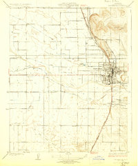
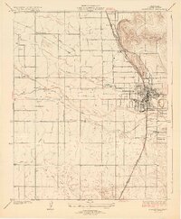
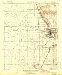
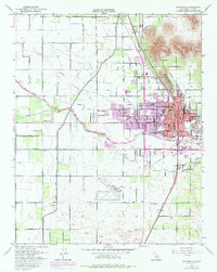
Loading map...1929 Map of Porterville
USGS Topo · Published 1929About this map
The agricultural landscape of Tulare County is defined by an intricate network of irrigation canals and two major rail lines during this late 1920s survey. Porterville serves as the central hub, where the Southern Pacific and Atchison Topeka and Santa Fe railroads converge near the foothills of Lewis Hill. The surrounding valley floor is heavily engineered for citrus and deciduous fruit production, evidenced by the dense grid of water works including the Poplar Ditch, Porter Slough, and Hubbs Miner Ditch.
Find a feature on this map
31 named features on this map. Tap any name to fly to it.
Don’t see what you’re looking for? This feature index may not catch every label — zoom into the map to look around manually.
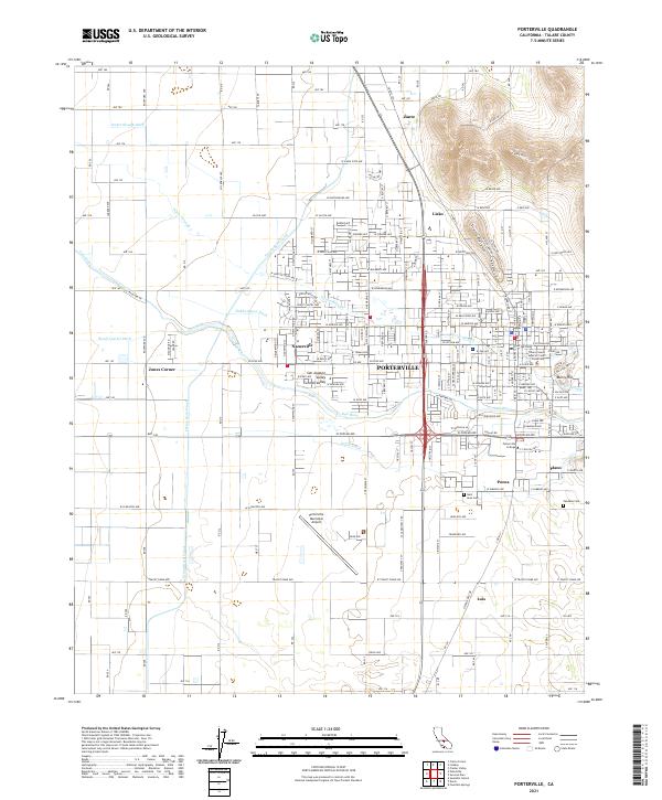
Map Details
Date Portrayed1929
Date Published1929
PublisherU.S. Geological Survey
Map TypeTopographic
Scale1:31680
Physical Dimensions16.4 x 19.8 inches
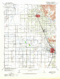
Editions of this 1929 Porterville Map
3 editions found
Historical Maps of Nanceville Through Time
4 maps found
Featured Locations
Source Details
SourceU.S. Geological Survey
CopyrightPublic Domain