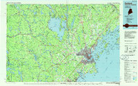
1985 Map of Portland
USGS Topo · Published 1986About this map
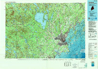
Casco Bay and the busy harbor of Portland dominate this mid-1980s regional perspective, showcasing a landscape where maritime heritage meets modern infrastructure. The urban core, including South Portland and Westbrook, is defined by its strategic position at the mouth of the Fore River, while the surrounding coast is dotted with significant landmarks like Cape Elizabeth, Prouts Neck, and numerous islands such as Chebeague Island and Cousins Island. Inland, the geography is anchored by the massive expanse of Sebago Lake, which serves as a major recreational and hydrologic hub for the region.
Find a feature on this map
219 named features on this map. Tap any name to fly to it.
Don’t see what you’re looking for? This feature index may not catch every label — zoom into the map to look around manually.
Map Details
Editions of this 1985 Portland Map
2 editions found
Other maps of this area

1891 · Portland
USGS Topo · 1:62,500

1891 · Biddeford
USGS Topo · 1:62,500

1891 · Berwick
USGS Topo · 1:62,500

1891 · Kennebunk
USGS Topo · 1:62,500

1891 · Buxton
USGS Topo · 1:62,500

1891 · Newfield
USGS Topo · 1:62,500

1892 · Gardiner
USGS Topo · 1:62,500

1892 · Freeport
USGS Topo · 1:62,500

1892 · Buxton
USGS Topo · 1:62,500

1893 · Kennebunk
USGS Topo · 1:62,500