1956 Map of Portland East
USGS Topo · Published 1966About this map
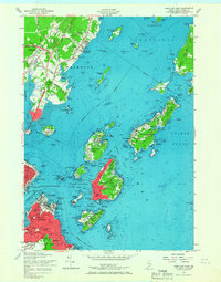
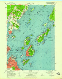
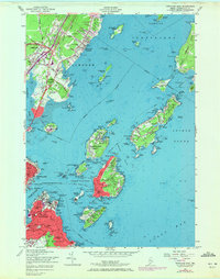
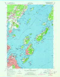
The islands of Casco Bay dominate this mid-century survey, revealing a landscape defined by coastal defenses and seasonal communities. Significant military presence is evident at U S Naval Res Fort Mc Kinley on Great Diamond Island and the U S Naval Reserve Training Center near the Fore River. In South Portland, the Fort Preble Maine Voc Tech Institute stands alongside the Coast Guard Terminal, marking a transition from traditional fortification to technical education and maritime service.
Find a feature on this map
120 named features on this map. Tap any name to fly to it.
Don’t see what you’re looking for? This feature index may not catch every label — zoom into the map to look around manually.
Map Details
Editions of this 1956 Portland East Map
5 editions found

Other maps of this area

1891 · Portland
USGS Topo · 1:62,500

1892 · Freeport
USGS Topo · 1:62,500

1893 · Portland
USGS Topo · 1:62,500

1893 · Casco Bay
USGS Topo · 1:62,500

1894 · Gray
USGS Topo · 1:62,500

1898 · Gray
USGS Topo · 1:62,500

1914 · Portland
USGS Topo · 1:48,000

1914 · Casco Bay
USGS Topo · 1:48,000

1916 · Portland
USGS Topo · 1:62,500

1916 · Casco Bay
USGS Topo · 1:62,500