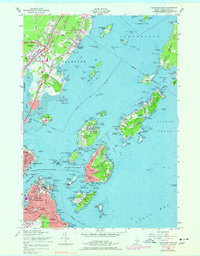
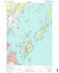
1956 Map of Portland East
USGS Topo · Published 1977About this map
Cushing Point and the busy waterfronts of South Portland and Portland anchor this mid-century coastal survey. The map details a landscape defined by maritime defense and industrial infrastructure, including the Portland Terminal Railroad and the Canadian National Railway lines feeding the harbor. Historic fortifications such as Fort Scammel on House Island and Fort McKinley on Great Diamond Island speak to the strategic significance of Casco Bay.
Find a feature on this map
114 named features on this map. Tap any name to fly to it.
Don’t see what you’re looking for? This feature index may not catch every label — zoom into the map to look around manually.
Map Details
Editions of this 1956 Portland East Map
5 editions found
Other maps of this area

1891 · Portland
USGS Topo · 1:62,500

1892 · Freeport
USGS Topo · 1:62,500

1893 · Portland
USGS Topo · 1:62,500

1893 · Casco Bay
USGS Topo · 1:62,500

1894 · Gray
USGS Topo · 1:62,500

1898 · Gray
USGS Topo · 1:62,500

1914 · Portland
USGS Topo · 1:48,000

1914 · Casco Bay
USGS Topo · 1:48,000

1916 · Portland
USGS Topo · 1:62,500

1916 · Casco Bay
USGS Topo · 1:62,500