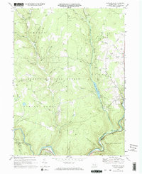
1969 Map of Portland Mills
USGS Topo · Published 1972About this map
Portland Mills serves as a focal point along the Clarion River in this detailed 1969 survey of Elk County. The landscape is defined by the intersection of industrial extraction and public lands, featuring the extensive Bear Creek Gas Field and the Allegheny National Forest. Transportation networks of the era are well-documented, showing the Penn Central and Baltimore and Ohio railroads following the river valley through State Game Lands No 44. Local landmarks such as Kings Airfield and the Ott Cem provide specific points of interest for genealogists and local historians. The presence of the Ridgway Reservoir on Big Mill Creek and various labeled runs like Italian Shanty Run and Bloody Run illustrate the complex drainage system of the Highland and Ridgway terrain.
Find a feature on this map
39 named features on this map. Tap any name to fly to it.
Don’t see what you’re looking for? This feature index may not catch every label — zoom into the map to look around manually.
Map Details
Editions of this 1969 Portland Mills Map
2 editions found
Other maps of this area

1934 · Kane
USGS Topo · 1:48,000

1935 · Mt. Jewett
USGS Topo · 1:48,000

1939 · Kane
USGS Topo · 1:62,500

1940 · Hallton
USGS Topo · 1:48,000

1940 · Mt. Jewett
USGS Topo · 1:62,500

1941 · Ridgway
USGS Topo · 1:62,500

1943 · Hallton
USGS Topo · 1:62,500

1944 · Ridgway
USGS Topo · 1:62,500

1957 · Warren
USGS Topo · 1:250,000

1958 · Warren
USGS Topo · 1:250,000
Featured Places
- Ridgway Township, PA
- Spring Creek Township, PA
- Highland Township, PA
- Portland Mills, Spring Creek Township
- Elk County, PA