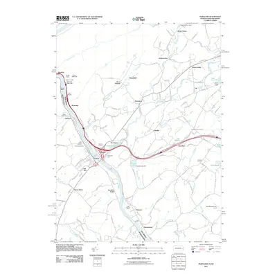
2011 Map of Portland
USGS Topo · Published 2011About this map
The Delaware River serves as the primary artery for this region of Warren County and eastern Pennsylvania, carving through the Delaware Water Gap where Indian Head and Mount Tammany rise above the banks. The river's influence on local development is evident in the cluster of settlements at Portland and Columbia, which are connected by the Columbia Dam and bridge infrastructure. Along the Paulins Kill and Delawanna Creek, smaller crossroads such as Hainesburg, Vail, and Knowlton define the landscape.
Find a feature on this map
155 named features on this map. Tap any name to fly to it.
Don’t see what you’re looking for? This feature index may not catch every label — zoom into the map to look around manually.
Map Details
Editions of this 2011 Portland Map
This is the sole edition of this map. No revisions or reprints were ever made.
Other maps of this area

1888 · Hackettstown
USGS Topo · 1:62,500

1891 · Wallpack
USGS Topo · 1:62,500

1891 · Delaware Water Gap
USGS Topo · 1:62,500

1893 · Delaware Water Gap
USGS Topo · 1:62,500

1893 · Wallpack
USGS Topo · 1:62,500

1894 · Hackettstown
USGS Topo · 1:62,500

1898 · Hackettstown
USGS Topo · 1:62,500

1900 · Raritan
USGS Topo · 1:125,000

1905 · Raritan
USGS Topo · 1:125,000

1905 · Hackettstown
USGS Topo · 1:62,500