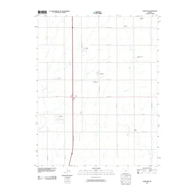
2010 Map of Portland
USGS Topo · Published 2010About this map
Portland anchors this rural Sumner County landscape, situated at the intersection of S Hydraulic Rd and E 150th St S. The map reveals an intensive history of petroleum extraction, with multiple designated areas such as the Portland Oil Field, Guelph Oil Field, and Ashton Northwest Oil Field scattered across the township grid. These fields indicate the subsurface wealth that shaped the local economy alongside traditional agriculture. Natural drainage is defined by the winding paths of Bitter Creek and Meridian Creek, which cut through the rectilinear road system. To the north, Forest Hill Cemetery serves as a significant genealogical landmark, reflecting the established community that has lived and worked among these oil fields and prairies. The grid of numbered roads, including E 120th St S through E 180th St S, provides a clear framework for locating specific family homesteads or industrial sites.
Find a feature on this map
25 named features on this map. Tap any name to fly to it.
Don’t see what you’re looking for? This feature index may not catch every label — zoom into the map to look around manually.
Map Details
Editions of this 2010 Portland Map
This is the sole edition of this map. No revisions or reprints were ever made.
Other maps of this area

1890 · Wellington
USGS Topo · 1:125,000

1955 · Wichita
USGS Topo · 1:250,000

1955 · Enid
USGS Topo · 1:250,000

1958 · Enid
USGS Topo · 1:250,000

1958 · Wichita
USGS Topo · 1:250,000

1964 · South Haven NE
USGS Topo · 1:24,000

1965 · Portland
USGS Topo · 1:24,000

1965 · Adamsville
USGS Topo · 1:24,000

1965 · South Haven
USGS Topo · 1:24,000

1965 · Geuda Springs
USGS Topo · 1:24,000