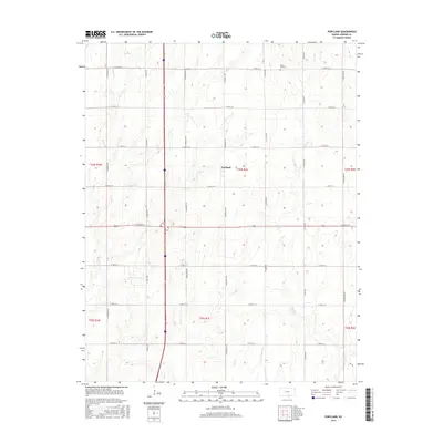
2015 Map of Portland
USGS Topo · Published 2015About this map
The small settlement of Portland sits at the heart of this Sumner County landscape, defined by a rigid grid of rural roads and the meandering paths of local waterways. The terrain is drained by Bitter Cr, Meridian Cr, and Dry Cr, which cut through the agricultural sections of the township. Local history and genealogy researchers will find Forest Hill Cem located in the northern portion of the survey area, a quiet landmark amidst the expansive farm plots. The map detail highlights the precision of the Public Land Survey System, with township and range boundaries such as t34s r1e and t35s r1e clearly delineated. This 2015 data provides a clear view of the modern rural infrastructure, showing how thoroughfares like E 160th St S and S Hydraulic Rd continue to organize the Kansas prairie long after the initial homesteading era.
Find a feature on this map
26 named features on this map. Tap any name to fly to it.
Don’t see what you’re looking for? This feature index may not catch every label — zoom into the map to look around manually.
Map Details
Editions of this 2015 Portland Map
This is the sole edition of this map. No revisions or reprints were ever made.
Other maps of this area

1890 · Wellington
USGS Topo · 1:125,000

1955 · Wichita
USGS Topo · 1:250,000

1955 · Enid
USGS Topo · 1:250,000

1958 · Enid
USGS Topo · 1:250,000

1958 · Wichita
USGS Topo · 1:250,000

1964 · South Haven NE
USGS Topo · 1:24,000

1965 · Portland
USGS Topo · 1:24,000

1965 · Adamsville
USGS Topo · 1:24,000

1965 · South Haven
USGS Topo · 1:24,000

1965 · Geuda Springs
USGS Topo · 1:24,000