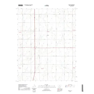
2018 Map of Portland
USGS Topo · Published 2018About this map
Portland sits at the heart of this rural landscape in Sumner County, where the regular geometry of the Public Land Survey System defines the human footprint. The map reveals a highly structured grid of section-line roads, including S Meridian Rd and S Broadway Rd, which facilitate the agricultural economy of the region. This rigid order is only interrupted by the natural meanders of Meridian Cr, Dry Cr, and the branching waters of Bitter Cr. For local historians and genealogists, the Forest Hill Cem in the northern portion of the quadrangle serves as a primary point of interest, marking a legacy of early settlement in the area. The landscape remains predominantly open, dominated by township boundaries such as t34s r1e and t35s r1e, reflecting the enduring rural character of south-central Kansas.
Find a feature on this map
27 named features on this map. Tap any name to fly to it.
Don’t see what you’re looking for? This feature index may not catch every label — zoom into the map to look around manually.
Map Details
Editions of this 2018 Portland Map
This is the sole edition of this map. No revisions or reprints were ever made.
Other maps of this area

1890 · Wellington
USGS Topo · 1:125,000

1955 · Wichita
USGS Topo · 1:250,000

1955 · Enid
USGS Topo · 1:250,000

1958 · Enid
USGS Topo · 1:250,000

1958 · Wichita
USGS Topo · 1:250,000

1964 · South Haven NE
USGS Topo · 1:24,000

1965 · Portland
USGS Topo · 1:24,000

1965 · Adamsville
USGS Topo · 1:24,000

1965 · South Haven
USGS Topo · 1:24,000

1965 · Geuda Springs
USGS Topo · 1:24,000