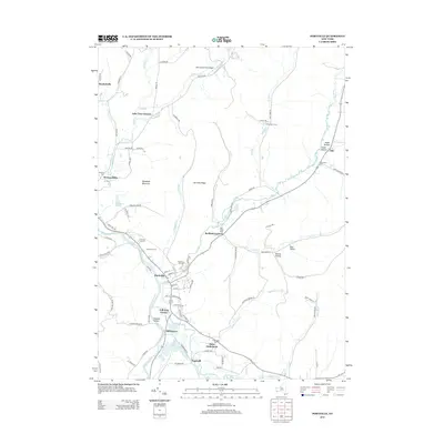
2013 Map of Portville
USGS Topo · Published 2013About this map
Portville serves as the focal point of this survey, situated at the convergence of the Allegheny River and Oswayo Cr. The settlement pattern follows the valley floors, with clusters of development appearing at Weston Mills and Mill Grove, while the surrounding elevations like Portville Ridge and Typnahda Mountain remain largely rural. Local infrastructure is well-documented, from the Portville Drive-In near the river to the Reiss Game Farm Airport in the northern reach. Several smaller locales such as Toll Gate Corner and Bedford Corners mark key road intersections, reflecting the historical transport network of Cattaraugus County. Genealogists will find four distinct burial grounds, including Chestnut Hill Cem and W Genesee Cem, which anchor the various hamlets across the landscape.
Find a feature on this map
87 named features on this map. Tap any name to fly to it.
Don’t see what you’re looking for? This feature index may not catch every label — zoom into the map to look around manually.
Map Details
Editions of this 2013 Portville Map
This is the sole edition of this map. No revisions or reprints were ever made.
Other maps of this area

1898 · Olean
USGS Topo · 1:62,500

1925 · Belmont
USGS Topo · 1:62,500

1933 · Smethport
USGS Topo · 1:62,500

1934 · Coudersport
USGS Topo · 1:48,000

1937 · Smethport
USGS Topo · 1:62,500

1938 · Coudersport
USGS Topo · 1:62,500

1938 · Olean
USGS Topo · 1:62,500

1939 · Belmont
USGS Topo · 1:62,500

1943 · Olean
USGS Topo · 1:62,500

1957 · Warren
USGS Topo · 1:250,000