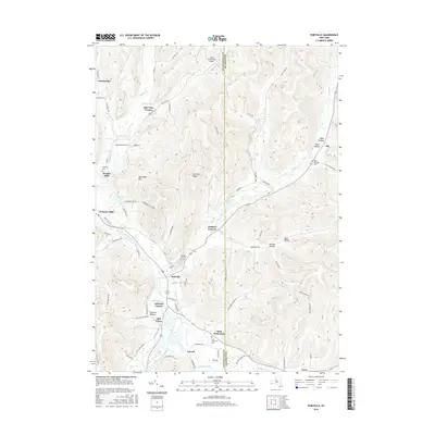
2016 Map of Portville
USGS Topo · Published 2016About this map
The Allegheny River valley forms a central corridor through this portion of the Southern Tier, where the village of Portville sits at the junction of Dodge Creek and Oswayo Creek. The settlement pattern follows the fertile bottomlands and narrow hollows, with older communities like Westons Mills and Ceres established along primary river routes. The landscape is defined by significant elevation changes, rising from the river floor toward summits like Typnahda Mtn and the prominent Portville Ridge. Local history is deeply etched into the geography through several burial grounds, including Chestnut Hill Cem and Portville Cem. Outside the main village centers, residential clusters like Main Settlement and Lake View Terrace show more contemporary development patterns, while the Reiss Game Farm Airport remains a notable landmark in the northern uplands. The convergence of numerous small waterways such as Lillibridge Cr and Wolf Creek into the larger river system highlights the area's historical reliance on these drainages for transport and industry.
Find a feature on this map
85 named features on this map. Tap any name to fly to it.
Don’t see what you’re looking for? This feature index may not catch every label — zoom into the map to look around manually.
Map Details
Editions of this 2016 Portville Map
This is the sole edition of this map. No revisions or reprints were ever made.
Other maps of this area

1898 · Olean
USGS Topo · 1:62,500

1925 · Belmont
USGS Topo · 1:62,500

1933 · Smethport
USGS Topo · 1:62,500

1934 · Coudersport
USGS Topo · 1:48,000

1937 · Smethport
USGS Topo · 1:62,500

1938 · Coudersport
USGS Topo · 1:62,500

1938 · Olean
USGS Topo · 1:62,500

1939 · Belmont
USGS Topo · 1:62,500

1943 · Olean
USGS Topo · 1:62,500

1957 · Warren
USGS Topo · 1:250,000