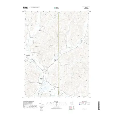
2019 Map of Portville
USGS Topo · Published 2019About this map
The Allegheny River valley serves as the central artery for this region of Cattaraugus and Allegany counties, where the river meets Oswayo Creek near the southern border. The village of Portville occupies a prominent bend in the river, surrounded by a dense network of smaller crossroads and residential developments like Lake View Terrace, Bedford Corners, and Toll Gate Corner. The landscape is defined by its deep drainage hollows, including Gleason Hollow and Coon Hollow, which cut through the high ground of Portville Ridge and Typnahda Mtn. Several burial grounds, such as Chestnut Hill Cem and the West Genesee Cem across the county line, provide significant points of interest for genealogical research in this long-settled river valley. To the north, the Reiss Game Farm Airport sits among the hills of Wolf Run, illustrating the blend of rural industry and local aviation that characterizes the modern era in western New York.
Find a feature on this map
93 named features on this map. Tap any name to fly to it.
Don’t see what you’re looking for? This feature index may not catch every label — zoom into the map to look around manually.
Map Details
Editions of this 2019 Portville Map
This is the sole edition of this map. No revisions or reprints were ever made.
Other maps of this area

1898 · Olean
USGS Topo · 1:62,500

1925 · Belmont
USGS Topo · 1:62,500

1933 · Smethport
USGS Topo · 1:62,500

1934 · Coudersport
USGS Topo · 1:48,000

1937 · Smethport
USGS Topo · 1:62,500

1938 · Coudersport
USGS Topo · 1:62,500

1938 · Olean
USGS Topo · 1:62,500

1939 · Belmont
USGS Topo · 1:62,500

1943 · Olean
USGS Topo · 1:62,500

1957 · Warren
USGS Topo · 1:250,000