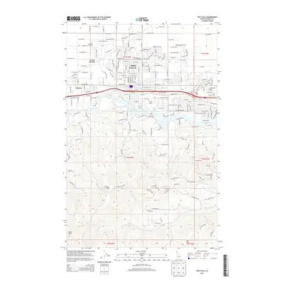
2013 Map of Post Falls
USGS Topo · Published 2013About this map
The Spokane River carves through the heart of this North Idaho landscape, separating the residential and commercial developments of Post Falls from the rising peaks of Blossom Mtn and Shasta Butte to the south. In the north, the flat expanse of Rathdrum Prairie is defined by a modern grid of residential avenues and historical markers like the Evergreen Cem and the former junction points of McGuire and Grand Junction.
Find a feature on this map
93 named features on this map. Tap any name to fly to it.
Don’t see what you’re looking for? This feature index may not catch every label — zoom into the map to look around manually.
Map Details
Editions of this 2013 Post Falls Map
This is the sole edition of this map. No revisions or reprints were ever made.
Other maps of this area

1901 · Spokane
USGS Topo · 1:125,000

1903 · Rathdrum
USGS Topo · 1:125,000

1943 · Mt Spokane
USGS Topo · 1:62,500

1949 · Greenacres
USGS Topo · 1:62,500

1950 · Mt Spokane
USGS Topo · 1:62,500

1951 · Greenacres
USGS Topo · 1:62,500

1955 · Spokane
USGS Topo · 1:250,000

1957 · Coeur D'Alene
USGS Topo · 1:62,500

1958 · Spokane
USGS Topo · 1:250,000

1961 · Hayden
USGS Topo · 1:24,000