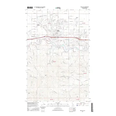
2017 Map of Post Falls
USGS Topo · Published 2017About this map
Post Falls serves as the central hub of this northern Idaho landscape, where the Spokane River cuts a deep, winding path through the southern half of the quadrangle. The city's grid expands north toward the Rathdrum Prairie, showing a clear transition from the urban density of the city center to the wide, straight avenues like W Prairie Ave. To the west, the settlements of McGuire and Grand Junction occupy the flatlands, while Ross Point sits at a strategic bend in the river.
Find a feature on this map
86 named features on this map. Tap any name to fly to it.
Don’t see what you’re looking for? This feature index may not catch every label — zoom into the map to look around manually.
Map Details
Editions of this 2017 Post Falls Map
This is the sole edition of this map. No revisions or reprints were ever made.
Other maps of this area

1901 · Spokane
USGS Topo · 1:125,000

1903 · Rathdrum
USGS Topo · 1:125,000

1943 · Mt Spokane
USGS Topo · 1:62,500

1949 · Greenacres
USGS Topo · 1:62,500

1950 · Mt Spokane
USGS Topo · 1:62,500

1951 · Greenacres
USGS Topo · 1:62,500

1955 · Spokane
USGS Topo · 1:250,000

1957 · Coeur D'Alene
USGS Topo · 1:62,500

1958 · Spokane
USGS Topo · 1:250,000

1961 · Hayden
USGS Topo · 1:24,000