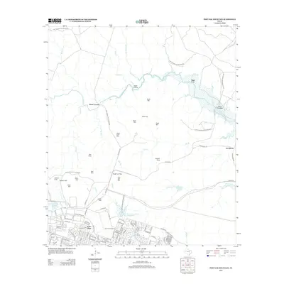
2012 Map of Post Oak Mountain
USGS Topo · Published 2012About this map
The Fort Hood Military Reservation dominates this landscape north of Killeen, Texas, where military infrastructure and rugged topography converge. To the south, the dense residential streets of Walker Village and the operational hub of Hood Army Airfield mark the edge of the base's urbanized footprint. Moving north, the terrain transitions into a series of prominent limestone ridges and peaks, including Post Oak Mountain, Sugar Loaf Mountain, and Castle Mountain. The network of watercourses, such as Cowhouse Creek and North Nolan Creek, reveals historic transit points like Mason Crossing, Riggs Ford, and Curry Crossing, which likely served as essential landmarks before and after the reservation’s establishment. The contrast between the rigid military grid and the winding drainages of Egypt Hollow and Stephenson Branch illustrates the complex land use in this part of Bell County.
Find a feature on this map
112 named features on this map. Tap any name to fly to it.
Don’t see what you’re looking for? This feature index may not catch every label — zoom into the map to look around manually.
Map Details
Editions of this 2012 Post Oak Mountain Map
This is the sole edition of this map. No revisions or reprints were ever made.
Other maps of this area

1894 · Gatesville
USGS Topo · 1:125,000

1924 · Gatesville 4-d
USGS Topo · 1:48,000

1924 · Gatesville 4-a
USGS Topo · 1:48,000

1930 · Killeen
USGS Topo · 1:62,500

1947 · Fort Hood
USGS Topo · 1:62,500

1947 · Bland
USGS Topo · 1:24,000

1947 · Fort Hood
USGS Topo · 1:24,000

1947 · Purmela
USGS Topo · 1:62,500

1947 · Post Oak Mountain
USGS Topo · 1:24,000

1947 · Killeen
USGS Topo · 1:62,500
Featured Places
- Killeen, TX
- Wainwright Heights North, TX
- Patton Park, TX
- Wainwright Heights, TX
- Wainwright Heights EXP, TX