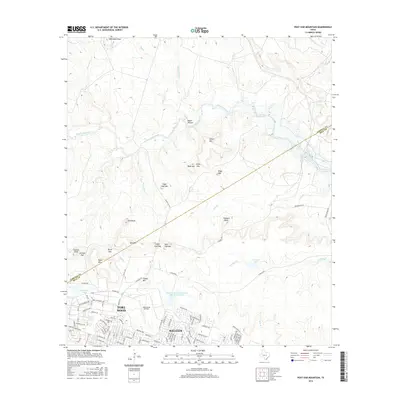
2016 Map of Post Oak Mountain
USGS Topo · Published 2016About this map
Fort Hood and the northern reaches of Killeen dominate this 2016 survey, showcasing the intense military and urban infrastructure of central Texas. The landscape is a network of specialized roads with names like Tank Destroyer Blvd, Hell on Wheels Ave, and Old Ironsides Ave, reflecting the storied armored divisions stationed here. Beyond the cantonment areas, the map reveals a complex terrain of named peaks and gaps, including Sugar Loaf Mtn, Post Oak Mtn, and Castle Mtn. These elevations overlook numerous drainages such as Cowhouse Creek and Bull Run. The presence of Hood Army Airfield and the Soil Conservation Service Site 5a Reservoir illustrates the dual priorities of military readiness and land management in the region. To the north, the terrain becomes more varied with landmarks like Egypt Hollow and Smith Mtn before crossing the Coryell and Bell County line.
Find a feature on this map
96 named features on this map. Tap any name to fly to it.
Don’t see what you’re looking for? This feature index may not catch every label — zoom into the map to look around manually.
Map Details
Editions of this 2016 Post Oak Mountain Map
This is the sole edition of this map. No revisions or reprints were ever made.
Other maps of this area

1894 · Gatesville
USGS Topo · 1:125,000

1924 · Gatesville 4-d
USGS Topo · 1:48,000

1924 · Gatesville 4-a
USGS Topo · 1:48,000

1930 · Killeen
USGS Topo · 1:62,500

1947 · Fort Hood
USGS Topo · 1:62,500

1947 · Bland
USGS Topo · 1:24,000

1947 · Fort Hood
USGS Topo · 1:24,000

1947 · Purmela
USGS Topo · 1:62,500

1947 · Post Oak Mountain
USGS Topo · 1:24,000

1947 · Killeen
USGS Topo · 1:62,500
Featured Places
- Killeen, TX
- Wainwright Heights North, TX
- Patton Park, TX
- Wainwright Heights, TX
- Wainwright Heights EXP, TX