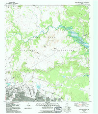
1994 Map of Post Oak Mountain
USGS Topo · Published 1995About this map
The Fort Hood Military Reservation dominates the Central Texas landscape in this mid-1990s survey, illustrating the complex intersection of military infrastructure and natural terrain. The northern expansion of Killeen and residential areas like Walker Village sit adjacent to the heavy operations at Hood Army Airfield, where a Heliport and numerous Athletic Fields serve the installation.
Find a feature on this map
50 named features on this map. Tap any name to fly to it.
Don’t see what you’re looking for? This feature index may not catch every label — zoom into the map to look around manually.
Map Details
Editions of this 1994 Post Oak Mountain Map
This is the sole edition of this map. No revisions or reprints were ever made.
Other maps of this area

1894 · Gatesville
USGS Topo · 1:125,000

1924 · Gatesville 4-d
USGS Topo · 1:48,000

1924 · Gatesville 4-a
USGS Topo · 1:48,000

1930 · Killeen
USGS Topo · 1:62,500

1947 · Fort Hood
USGS Topo · 1:62,500

1947 · Bland
USGS Topo · 1:24,000

1947 · Fort Hood
USGS Topo · 1:24,000

1947 · Purmela
USGS Topo · 1:62,500

1947 · Post Oak Mountain
USGS Topo · 1:24,000

1947 · Killeen
USGS Topo · 1:62,500