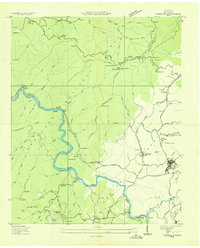
1936 Map of Postelle
USGS Topo · Published 1936About this map
The industrial and agricultural landscape of Polk County is defined here by the Ocoee River and the copper-rich corridor around Ducktown. The Tennessee Valley Authority influence is evident through the presence of the Tenn Elec Pwr Co Dam No 2 and extensive transmission lines following the river's winding course. Mining heritage is anchored by the Burra Burra Mine and the Old Tennessee Mine, which were central to the local economy alongside the Louisville and Nashville Railroad that serviced Ducktown Station and Stansbury Siding.
Find a feature on this map
98 named features on this map. Tap any name to fly to it.
Don’t see what you’re looking for? This feature index may not catch every label — zoom into the map to look around manually.
Map Details
Editions of this 1936 Postelle Map
This is the sole edition of this map. No revisions or reprints were ever made.
Other maps of this area

1886 · Dalton
USGS Topo · 1:125,000

1886 · Cleveland
USGS Topo · 1:125,000

1888 · Ellijay
USGS Topo · 1:125,000

1892 · Cleveland
USGS Topo · 1:125,000

1892 · Ellijay
USGS Topo · 1:125,000

1892 · Dalton
USGS Topo · 1:125,000

1893 · Murphy
USGS Topo · 1:125,000

1895 · Cleveland
USGS Topo · 1:125,000

1897 · Dalton
USGS Topo · 1:125,000

1898 · Ellijay
USGS Topo · 1:125,000