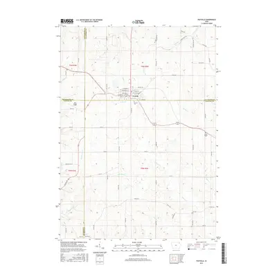
2015 Map of Postville
USGS Topo · Published 2015About this map
Postville serves as the central hub for this corner of northeast Iowa, where the borders of Allamakee, Clayton, Fayette, and Winneshiek counties converge. The town's grid is detailed with street-level precision, including W Tilden St, E Greene St, and Lybrand St, while the surrounding landscape is defined by the branching tributaries of Roberts Cr and Williams Cr. Family and community history is anchored by several rural burial grounds, such as Minert Cem to the north and Fry Cem to the southeast. The survey also captures the local aviation footprint at Dale Delight Airport west of the city. The township and range lines of t96n r6w and its neighbors delineate a structured agricultural environment, woven together by a network of county roads like Co Hwy W62 and Co Hwy B38 that connect the scattered farmsteads across the rolling Iowa terrain.
Find a feature on this map
65 named features on this map. Tap any name to fly to it.
Don’t see what you’re looking for? This feature index may not catch every label — zoom into the map to look around manually.
Map Details
Editions of this 2015 Postville Map
This is the sole edition of this map. No revisions or reprints were ever made.
Other maps of this area

1901 · Oelwein
USGS Topo · 1:125,000

1902 · Elkader
USGS Topo · 1:125,000

1903 · Waukon
USGS Topo · 1:125,000

1906 · Decorah
USGS Topo · 1:125,000

1958 · La Crosse
USGS Topo · 1:250,000

1959 · Dubuque
USGS Topo · 1:250,000

1961 · Dubuque
USGS Topo · 1:250,000

1961 · La Crosse
USGS Topo · 1:250,000

1962 · Dubuque
USGS Topo · 1:250,000

1965 · La Crosse
USGS Topo · 1:250,000