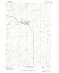
1971 Map of Postville
USGS Topo · Published 1973About this map
Postville sits at the nexus of four counties—Allamakee, Clayton, Fayette, and Winneshiek—serving as a vital rail and transit hub for the surrounding agricultural prairie in the early 1970s. The Chicago Milwaukee St Paul and Pacific railroad cuts a diagonal path through the landscape, anchoring the town's industrial and municipal development. The presence of a Fairground and local Townhall reflects the civic life of the township divisions, while the infrastructure of the era is evident in the Radio Tower and series of Sewage Disposal Ponds near the tracks.
Find a feature on this map
26 named features on this map. Tap any name to fly to it.
Don’t see what you’re looking for? This feature index may not catch every label — zoom into the map to look around manually.
Map Details
Editions of this 1971 Postville Map
This is the sole edition of this map. No revisions or reprints were ever made.
Other maps of this area

1901 · Oelwein
USGS Topo · 1:125,000

1902 · Elkader
USGS Topo · 1:125,000

1903 · Waukon
USGS Topo · 1:125,000

1906 · Decorah
USGS Topo · 1:125,000

1958 · La Crosse
USGS Topo · 1:250,000

1959 · Dubuque
USGS Topo · 1:250,000

1961 · Dubuque
USGS Topo · 1:250,000

1961 · La Crosse
USGS Topo · 1:250,000

1962 · Dubuque
USGS Topo · 1:250,000

1965 · La Crosse
USGS Topo · 1:250,000