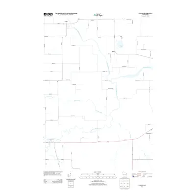
2013 Map of Potter
USGS Topo · Published 2013About this map
The North Branch Manitowoc River and South Branch Manitowoc River converge in this agricultural region of Calumet County, forming the headwaters of the Manitowoc River. The settlement of Potter sits at the northern edge of the map along Main St, while the small community of Wells occupies a central position near Bullhead Lake. To the south, the village of Hayton is situated along Us-151 near the winding course of Pine Creek. The landscape is defined by its drainage patterns, notably the Killsnake River which meanders through the central plains. A grid of rural roads, including Co Hwy-Y and Co Hwy-JJ, connects scattered farmsteads and family lands such as those along Harke Rd and Aebischer RD. This 2013 survey provides a clear view of the modern rural infrastructure and watercourses that have shaped local township development since the nineteenth century.
Find a feature on this map
60 named features on this map. Tap any name to fly to it.
Don’t see what you’re looking for? This feature index may not catch every label — zoom into the map to look around manually.
Map Details
Editions of this 2013 Potter Map
This is the sole edition of this map. No revisions or reprints were ever made.
Other maps of this area

1954 · School Hill
USGS Topo · 1:24,000

1954 · Howards Grove
USGS Topo · 1:62,500

1954 · Chilton
USGS Topo · 1:62,500

1954 · Reedsville
USGS Topo · 1:62,500

1954 · Kiel
USGS Topo · 1:62,500

1954 · Milwaukee
USGS Topo · 1:250,000

1954 · Manitowoc
USGS Topo · 1:250,000

1955 · Green Bay
USGS Topo · 1:250,000

1957 · Madison
USGS Topo · 1:250,000

1958 · Manitowoc
USGS Topo · 1:250,000