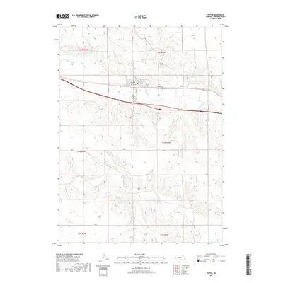
2017 Map of Potter
USGS Topo · Published 2017About this map
Potter sits as the central hub of this High Plains landscape, where the local grid includes historic thoroughfares like Front St and Sherman St. The village is situated along the course of Lodgepole Creek, a vital water source in this semi-arid region of western Nebraska. Just south of the main settlement, the Potter Community Cem serves as a significant landmark for genealogical research, while the surrounding terrain is defined by the drainage patterns of Sand Draw and the Willoughby Reservoir. The map reveals a transition from the organized street blocks of the town to the broad section lines of the Cheyenne County countryside, intersected by a network of rural routes such as Cheyenne Co Rd. This layout illustrates the enduring reliance on the creek valley for transportation and settlement in a landscape dominated by agricultural divisions.
Find a feature on this map
32 named features on this map. Tap any name to fly to it.
Don’t see what you’re looking for? This feature index may not catch every label — zoom into the map to look around manually.
Map Details
Editions of this 2017 Potter Map
This is the sole edition of this map. No revisions or reprints were ever made.
Other maps of this area

1954 · Scottsbluff
USGS Topo · 1:250,000

1958 · Scottsbluff
USGS Topo · 1:250,000

1972 · Mud Springs SW
USGS Topo · 1:24,000

1972 · Easterly Airport
USGS Topo · 1:24,000

1972 · Potter SW
USGS Topo · 1:24,000

1972 · Dix
USGS Topo · 1:24,000

1972 · Point Of Rocks
USGS Topo · 1:24,000

1972 · Potter SE
USGS Topo · 1:24,000

1972 · Potter
USGS Topo · 1:24,000

1973 · Potter 2 SW
USGS Topo · 1:24,000