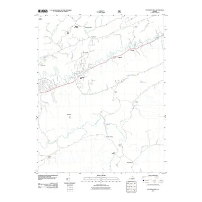
2011 Map of Pounding Mill
USGS Topo · Published 2011About this map
The Clinch River meanders through the heart of this Tazewell County landscape, defining the settlement patterns and transport corridors of the early 21st century. The namesake community of Pounding Mill serves as a central point where the valley's drainage, including Pounding Mill Branch, meets the primary river system. This area is characterized by family-named localities and distinct rural settlements such as Joe Whites, Van Dyke, and Whites Store, which suggest a long history of local residency and land ownership in the region's agricultural valleys. The southern portion of the map is dominated by the broad drainage of Maiden Spring Creek and the Little River, framed by significant elevations like Paint Lick Mountain and Bald Rock. From the concentrated residential streets near the Cedar Hills Raceway to the isolated hollows of Caleb Hollow, the map provides a look at the modern balance between valley industry and the enduring topography of the Clinch River basin.
Find a feature on this map
75 named features on this map. Tap any name to fly to it.
Don’t see what you’re looking for? This feature index may not catch every label — zoom into the map to look around manually.
Map Details
Editions of this 2011 Pounding Mill Map
This is the sole edition of this map. No revisions or reprints were ever made.
Other maps of this area

1891 · Tazewell
USGS Topo · 1:125,000

1891 · Abingdon
USGS Topo · 1:125,000

1894 · Abingdon
USGS Topo · 1:125,000

1895 · Tazewell
USGS Topo · 1:125,000

1897 · Tazewell
USGS Topo · 1:125,000

1909 · Abingdon
USGS Topo · 1:96,000

1911 · Abingdon
USGS Topo · 1:125,000

1912 · Pounding Mill
USGS Topo · 1:62,500

1915 · Richlands
USGS Topo · 1:48,000

1916 · Pounding Mill
USGS Topo · 1:62,500