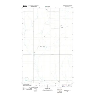
2011 Map of Poverty Coulee
USGS Topo · Published 2011About this map
Cottonwood Creek meanders through this high plains landscape of Liberty County, carving a network of drainage features that define the regional geography. The terrain is characterized by numerous named coulees, such as Poverty Coulee, Manton Coulee, and Stellner Coulee, which illustrate the complex erosional patterns of this Montana prairie. To the southwest, the Gagnon Reservoir stands as a significant hydrological marker in an otherwise arid expanse. Transportation across these drainage systems is facilitated by Fas 223 and Black Coulee Rd, which intersect the section lines of the rural grid. This 2011 survey documents the persistent agricultural and ranching layout of the area, where water management and topographical navigation remain central to local life.
Find a feature on this map
15 named features on this map. Tap any name to fly to it.
Don’t see what you’re looking for? This feature index may not catch every label — zoom into the map to look around manually.
Map Details
Editions of this 2011 Poverty Coulee Map
This is the sole edition of this map. No revisions or reprints were ever made.
Other maps of this area

1919 · Alma
USGS Topo · 1:125,000

1954 · Shelby
USGS Topo · 1:250,000

1958 · Shelby
USGS Topo · 1:250,000

1962 · Tiber
USGS Topo · 1:24,000

1963 · Joplin
USGS Topo · 1:24,000

1963 · Chester
USGS Topo · 1:24,000

1970 · Circle Bridge
USGS Topo · 1:24,000

1970 · Poverty Coulee NE
USGS Topo · 1:24,000

1970 · Sagebrush Coulee
USGS Topo · 1:24,000

1970 · Poverty Coulee SE
USGS Topo · 1:24,000