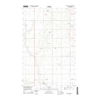
2014 Map of Poverty Coulee
USGS Topo · Published 2014About this map
Cottonwood Cr meanders across this northern Montana landscape, carving a primary drainage route through Liberty County. The terrain is defined by a dense network of coulees that channel seasonal runoff toward larger water bodies, including Tiber Coulee and Poverty Coulee. In the southwest corner, the Gagnon Reservoir provides a managed water source near the confluence of several minor drainages. This 2014 survey reveals a geometric grid of rural routes such as MT-223 and 4000 RD S, which facilitate transit across the high plains. Named for local families or early settlers, features like Loranger Coulee, Clausen Coulee, and Stellner Coulee offer specific points of interest for genealogists tracing family land holdings in the Hi-Line region.
Find a feature on this map
32 named features on this map. Tap any name to fly to it.
Don’t see what you’re looking for? This feature index may not catch every label — zoom into the map to look around manually.
Map Details
Editions of this 2014 Poverty Coulee Map
This is the sole edition of this map. No revisions or reprints were ever made.
Other maps of this area

1919 · Alma
USGS Topo · 1:125,000

1954 · Shelby
USGS Topo · 1:250,000

1958 · Shelby
USGS Topo · 1:250,000

1962 · Tiber
USGS Topo · 1:24,000

1963 · Joplin
USGS Topo · 1:24,000

1963 · Chester
USGS Topo · 1:24,000

1970 · Circle Bridge
USGS Topo · 1:24,000

1970 · Poverty Coulee NE
USGS Topo · 1:24,000

1970 · Sagebrush Coulee
USGS Topo · 1:24,000

1970 · Poverty Coulee SE
USGS Topo · 1:24,000