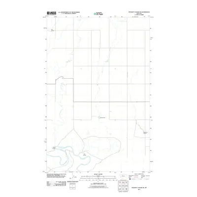
2011 Map of Poverty Coulee SE
USGS Topo · Published 2011About this map
The Marias River meanders through the southern portion of this landscape, its path defined by deep bends and the surrounding terrain of the northern Montana plains. This area is characterized by a series of significant drainage features, most notably Cottonwood Creek and several named coulees that illustrate the natural erosion patterns of the region. Local infrastructure is minimal, centered around the South Joplin Rd corridor and water management features like the Nahrgang Dam. The naming of features such as Wolfe Coulee, Kjar Coulee, and Hay Coulee suggests the early influence of ranching and settlement families on the local geography. These landmarks, along with Eightmile Coulee, provide a clear view of the rural township and range structure used for land organization in Hill County.
Find a feature on this map
8 named features on this map. Tap any name to fly to it.
Don’t see what you’re looking for? This feature index may not catch every label — zoom into the map to look around manually.
Map Details
Editions of this 2011 Poverty Coulee SE Map
This is the sole edition of this map. No revisions or reprints were ever made.
Other maps of this area

1954 · Shelby
USGS Topo · 1:250,000

1958 · Shelby
USGS Topo · 1:250,000

1969 · Dutch Henry Coulee
USGS Topo · 1:24,000

1970 · Circle Bridge
USGS Topo · 1:24,000

1970 · Poverty Coulee NE
USGS Topo · 1:24,000

1970 · Penzer School
USGS Topo · 1:24,000

1970 · Poverty Coulee SE
USGS Topo · 1:24,000

1970 · Goose Bill Butte NW
USGS Topo · 1:24,000

1970 · Rocky Coulee SW
USGS Topo · 1:24,000

1970 · Rocky Coulee
USGS Topo · 1:24,000