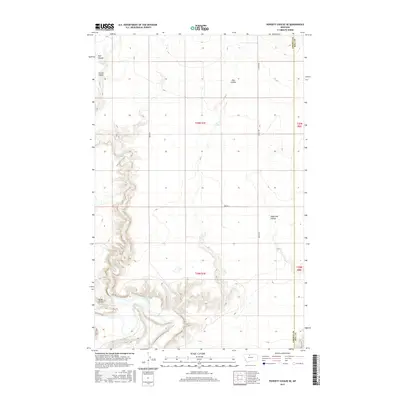
2017 Map of Poverty Coulee SE
USGS Topo · Published 2017About this map
The Marias River meanders through the southern portion of this landscape, carving deep, intricate drainages into the high plains of north-central Montana. The map illustrates a characteristic prairie topography where dry ravines, or coulees, dominate the terrain, including Eightmile Coulee and the winding course of Cottonwood Cr. These features define the natural drainage patterns toward the river valley, a stark contrast to the rigid geometry of the Public Land Survey System and the local road network.
Find a feature on this map
17 named features on this map. Tap any name to fly to it.
Don’t see what you’re looking for? This feature index may not catch every label — zoom into the map to look around manually.
Map Details
Editions of this 2017 Poverty Coulee SE Map
This is the sole edition of this map. No revisions or reprints were ever made.
Other maps of this area

1954 · Shelby
USGS Topo · 1:250,000

1958 · Shelby
USGS Topo · 1:250,000

1969 · Dutch Henry Coulee
USGS Topo · 1:24,000

1970 · Circle Bridge
USGS Topo · 1:24,000

1970 · Poverty Coulee NE
USGS Topo · 1:24,000

1970 · Penzer School
USGS Topo · 1:24,000

1970 · Poverty Coulee SE
USGS Topo · 1:24,000

1970 · Goose Bill Butte NW
USGS Topo · 1:24,000

1970 · Rocky Coulee SW
USGS Topo · 1:24,000

1970 · Rocky Coulee
USGS Topo · 1:24,000