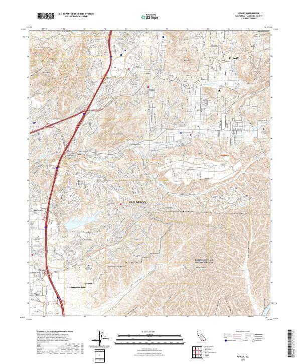
2021 Map of Poway
USGS Topo · Published 2021About this map
Poway Valley serves as the central hub of this inland landscape, where modern residential expansion meets a complex network of natural drainages. The area is defined by its deep canyons, including Los Penasquitos Canyon and Beeler Canyon, which create a rugged north-south orientation for development. Critical water infrastructure is visible through the paths of the San Diego Aqueduct and the Second San Diego Aqueduct, underlining the engineering required to sustain these communities. Local history is anchored by sites like the Smith Pioneer Cem and Dearborn Memorial Park, while the southern portion of the sheet transitions into the academic and industrial corridors of Miramar, featuring San Diego Miramar College and Alliant International University. The map also captures the recreational and environmental corridors along the Transcounty Trail 28 Trl.
Find a feature on this map
50 named features on this map. Tap any name to fly to it.
Don’t see what you’re looking for? This feature index may not catch every label — zoom into the map to look around manually.
Map Details
Editions of this 2021 Poway Map
This is the sole edition of this map. No revisions or reprints were ever made.
Historical Maps of San Diego Through Time
3 maps found