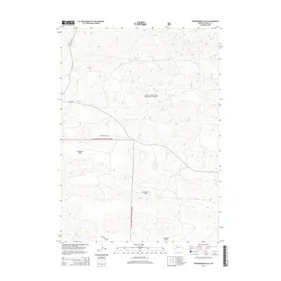
2014 Map of Powderhorn Valley
USGS Topo · Published 2014About this map
Sam R. McKelvie National Forest dominates this section of the Nebraska Sandhills, where the landscape is defined by vast depressions and seasonal water. The terrain is segmented into distinct drainages including Chamberlain Valley, Powderhorn Valley, and Tombstone Valley, illustrating the unique topography of the Cherry County interior. Small-scale ranching and remote land management are evident through the network of local routes like Powder Horn Ranch Rd and the presence of State Hwy Spur 16F at the western edge. Genealogists and local historians will find the adjacent Lamson Cem and Larson Cem near the southern boundary particularly notable for tracing early settler footprints. Hydrological features such as Steer Cr and the Lord Lakes provide critical water points in this arid environment, showing the natural resources that supported isolated homesteads and forest service operations.
Find a feature on this map
12 named features on this map. Tap any name to fly to it.
Don’t see what you’re looking for? This feature index may not catch every label — zoom into the map to look around manually.
Map Details
Editions of this 2014 Powderhorn Valley Map
This is the sole edition of this map. No revisions or reprints were ever made.
Other maps of this area

1950 · Powderhorn Valley
USGS Topo · 1:62,500

1950 · Kennedy
USGS Topo · 1:62,500

1950 · Kilgore
USGS Topo · 1:62,500

1950 · Cody
USGS Topo · 1:62,500

1957 · Valentine
USGS Topo · 1:250,000

1959 · Valentine
USGS Topo · 1:250,000

1985 · Powderhorn Valley SW
USGS Topo · 1:24,000

1985 · Cooper Canyon
USGS Topo · 1:24,000
1985 · Cody SE
USGS Topo · 1:24,000

1985 · Cody
USGS Topo · 1:100,000