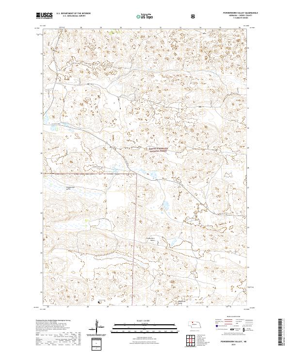
2021 Map of Powderhorn Valley
USGS Topo · Published 2021About this map
The Samuel R McKelvie National Forest anchors this section of Cherry County, Nebraska, where the landscape is defined by the unique topography of the Sandhills. This 2021 survey reveals a region of expansive valleys, including Chamberlain Valley, Tombstone Valley, and the namesake Powderhorn Valley. The presence of the Lamson Cem near the southern boundary provides a specific point of interest for genealogists tracing local families in this sparsely settled area. Water resources are concentrated around the Lord Lakes and the drainage of Steer Cr to the north. Transportation in this ranching country is limited to specialized routes like the Powder Horn Ranch Rd and the 16 F to 97 Rd, reflecting the remote and rural character of the Nebraska panhandle’s grazing lands.
Find a feature on this map
13 named features on this map. Tap any name to fly to it.
Don’t see what you’re looking for? This feature index may not catch every label — zoom into the map to look around manually.
Map Details
Editions of this 2021 Powderhorn Valley Map
This is the sole edition of this map. No revisions or reprints were ever made.
Other maps of this area

1950 · Powderhorn Valley
USGS Topo · 1:62,500

1950 · Kennedy
USGS Topo · 1:62,500

1950 · Kilgore
USGS Topo · 1:62,500

1950 · Cody
USGS Topo · 1:62,500

1957 · Valentine
USGS Topo · 1:250,000

1959 · Valentine
USGS Topo · 1:250,000

1985 · Powderhorn Valley SW
USGS Topo · 1:24,000

1985 · Cooper Canyon
USGS Topo · 1:24,000
1985 · Cody SE
USGS Topo · 1:24,000

1985 · Cody
USGS Topo · 1:100,000