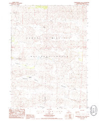
1985 Map of Powderhorn Valley
USGS Topo · Published 1985About this map
Samuel R McKelvie National Forest dominates this landscape in Cherry County, Nebraska, as it appeared in the mid-1980s. The topography is defined by the unique sandhills environment, where sweeping depressions like Chamberlain Valley and Powderhorn Valley cut through the terrain. Human presence is sparse, centered on the Powderhorn Ranch, reflecting the region's enduring ranching heritage. Water is a critical but localized resource, found at Steer Creek in the north and the clustered Lord Lakes. These natural features, alongside landmarks like Eagle Point and Tombstone Valley, reveal the remote character of this Nebraska cattle country before modern developments altered the rural infrastructure of the High Plains.
Find a feature on this map
9 named features on this map. Tap any name to fly to it.
Don’t see what you’re looking for? This feature index may not catch every label — zoom into the map to look around manually.
Map Details
Editions of this 1985 Powderhorn Valley Map
This is the sole edition of this map. No revisions or reprints were ever made.
Other maps of this area

1950 · Powderhorn Valley
USGS Topo · 1:62,500

1950 · Kennedy
USGS Topo · 1:62,500

1950 · Kilgore
USGS Topo · 1:62,500

1950 · Cody
USGS Topo · 1:62,500

1957 · Valentine
USGS Topo · 1:250,000

1959 · Valentine
USGS Topo · 1:250,000

1985 · Powderhorn Valley SW
USGS Topo · 1:24,000

1985 · Cooper Canyon
USGS Topo · 1:24,000
1985 · Cody SE
USGS Topo · 1:24,000

1985 · Cody
USGS Topo · 1:100,000