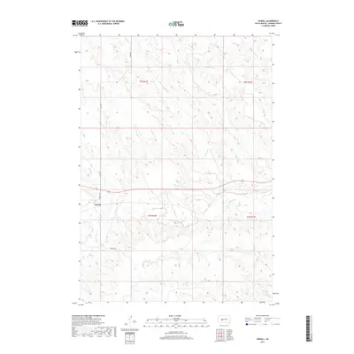
2017 Map of Powell
USGS Topo · Published 2017About this map
The small settlement of Powell sits at the intersection of Powell Rd and Cronk Rd, serving as a central point in this stretch of Haakon County. The landscape is primarily defined by the intricate drainage systems of the Bad River and several significant tributaries, including Witcher Holes Cr and Buzzard Cr. These watercourses carve through the West River terrain, creating a complex network of seasonal creeks and draws such as Medicine Cr and Sarah Laribee Cr.
Find a feature on this map
15 named features on this map. Tap any name to fly to it.
Don’t see what you’re looking for? This feature index may not catch every label — zoom into the map to look around manually.
Map Details
Editions of this 2017 Powell Map
This is the sole edition of this map. No revisions or reprints were ever made.
Other maps of this area

1953 · Belvidere NE
USGS Topo · 1:24,000

1953 · Philip SE
USGS Topo · 1:24,000

1954 · Belvidere NW
USGS Topo · 1:24,000

1954 · Kadoka NE
USGS Topo · 1:24,000

1954 · Powell
USGS Topo · 1:24,000

1954 · Nowlin
USGS Topo · 1:24,000

1954 · Pierre
USGS Topo · 1:250,000

1955 · Martin
USGS Topo · 1:250,000

1958 · Pierre
USGS Topo · 1:250,000

1958 · Martin
USGS Topo · 1:250,000