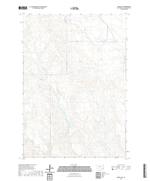
2021 Map of Powell NW
USGS Topo · Published 2021About this map
Witcher-Holes Creek and its many tributaries, including Witcher Holes Cr and Buzzard Cr, define the drainage patterns of this Haakon County landscape. This 2021 survey reveals a remote prairie environment characterized by intermittent watercourses and a sparse, grid-based road network. In the northeast, Mitchell Cr flows toward the east, while Sarah Laribee Cr and Nowlin Cr mark the southeastern reaches of the quadrangle. Access to this territory is primarily via Cronk Rd and 233rd Ave, highlighting the organized but isolated nature of rural South Dakota ranch land. The terrain is divided into sections such as t3n r22e and t2n r23e, illustrating the lasting impact of the Public Land Survey System on the modern geography of the Great Plains.
Find a feature on this map
15 named features on this map. Tap any name to fly to it.
Don’t see what you’re looking for? This feature index may not catch every label — zoom into the map to look around manually.
Map Details
Editions of this 2021 Powell NW Map
This is the sole edition of this map. No revisions or reprints were ever made.
Other maps of this area

1953 · Philip SE
USGS Topo · 1:24,000

1954 · Powell
USGS Topo · 1:24,000

1954 · Nowlin
USGS Topo · 1:24,000

1954 · Pierre
USGS Topo · 1:250,000

1958 · Pierre
USGS Topo · 1:250,000

1983 · Mule Creek
USGS Topo · 1:24,000

1983 · Philip
USGS Topo · 1:100,000

1983 · Powell NW
USGS Topo · 1:24,000

1983 · Tornado Ranch
USGS Topo · 1:24,000
1983 · Ottumwa
USGS Topo · 1:24,000