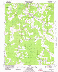
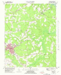
1982 Map of Powellsville
USGS Topo · Published 1982About this map
Pell Mell Pocosin dominates the southern landscape of this Bertie County quadrangle, where a complex network of wetland drainages including Ahoskie Swamp and Quioccosin Swamp weave through the forest and farmland. The settlement of Powellsville serves as a local hub, situated near the Highland Mem Cem and the White Sch. The presence of an Old Railroad Grade running north-south through the center of the sheet indicates the shifting transportation priorities of this rural district as it transitioned away from rail-dependent timber or agricultural hauling.
Find a feature on this map
26 named features on this map. Tap any name to fly to it.
Don’t see what you’re looking for? This feature index may not catch every label — zoom into the map to look around manually.
Map Details
Editions of this 1982 Powellsville Map
This is the sole edition of this map. No revisions or reprints were ever made.
Other maps of this area

1908 · Winton
USGS Topo · 1:62,500

1953 · Norfolk
USGS Topo · 1:250,000
1972 · Republican
USGS Topo · 1:24,000
1972 · Aulander
USGS Topo · 1:24,000
1977 · Union
USGS Topo · 1:24,000
1981 · Windsor North
USGS Topo · 1:24,000
1982 · Colerain
USGS Topo · 1:24,000
1982 · Merry Hill
USGS Topo · 1:24,000
1982 · Harrellsville
USGS Topo · 1:24,000
1982 · Ahoskie
USGS Topo · 1:24,000