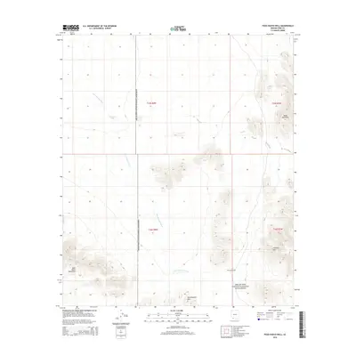
2014 Map of Pozo Nuevo Well
USGS Topo · Published 2014About this map
Organ Pipe Cactus National Monument dominates this desert landscape, where water and topography define the few points of human history. The eponymous Pozo Nuevo Well stands as a vital landmark in the arid terrain, while Jose Juan Tank provides another essential water catchment in a region carved by the wandering San Cristobal Wash. The topography is marked by several distinct mountain ranges, including the Bates Mountains in the northeast and the Agua Dulce Mountains to the southwest. Between these peaks lie the Quitobaquito Hills and the Cipriano Hills, illustrating the complex geological formations that have dictated travel and survival in this corner of Pima County. This 2014 survey captures the intersection of conservation lands and the ancient hydrological patterns of the Sonoran Desert.
Find a feature on this map
12 named features on this map. Tap any name to fly to it.
Don’t see what you’re looking for? This feature index may not catch every label — zoom into the map to look around manually.
Map Details
Editions of this 2014 Pozo Nuevo Well Map
This is the sole edition of this map. No revisions or reprints were ever made.
Other maps of this area

1953 · Ajo
USGS Topo · 1:250,000

1954 · Sonoyta
USGS Topo · 1:250,000

1957 · Ajo
USGS Topo · 1:250,000

1958 · Ajo
USGS Topo · 1:250,000

1962 · Ajo
USGS Topo · 1:250,000

1963 · Ajo
USGS Topo · 1:250,000

1963 · Lukeville
USGS Topo · 1:62,500

1963 · Quitobaquito Springs
USGS Topo · 1:62,500

1963 · Kino Peak
USGS Topo · 1:62,500

1963 · Lukeville
USGS Topo · 1:250,000