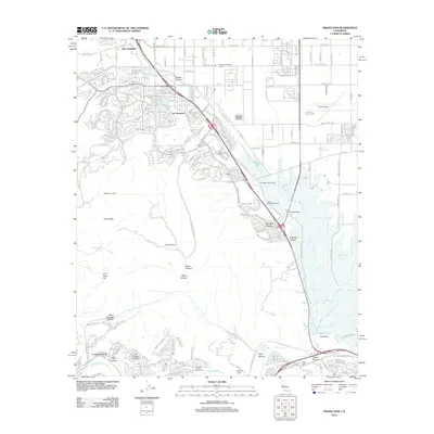
2012 Map of Prado Dam
USGS Topo · Published 2012About this map
Prado Dam and the sprawling flood basin of the Santa Ana River anchor this 2012 topographic record of the Chino Valley's edge. The landscape transitions from the dense suburban residential patterns of Los Serranos and Chino Hills into a corridor of preserved history and open space. Notable landmarks include the Yorba Slaughter Adobe and the Boys Republic campus, while the Chino Airport marks the eastern industrial margin. The southern half of the map is defined by a network of drainage canyons including Slaughter Canyon, Abacherli Canyon, and Banie Canyon, which cut through the uplift of San Juan Hill. This survey provides a clear view of the intersection between massive regional infrastructure and the legacy of the area's earlier ranching days, evidenced by the McDermont Ranch and Rolling M Ranch.
Find a feature on this map
40 named features on this map. Tap any name to fly to it.
Don’t see what you’re looking for? This feature index may not catch every label — zoom into the map to look around manually.
Map Details
Editions of this 2012 Prado Dam Map
This is the sole edition of this map. No revisions or reprints were ever made.
Other maps of this area

1894 · Pomona
USGS Topo · 1:62,500

1896 · Anaheim
USGS Topo · 1:62,500

1897 · Pomona
USGS Topo · 1:62,500

1897 · Cucamonga
USGS Topo · 1:62,500

1898 · Pomona
USGS Topo · 1:62,500

1898 · Anaheim
USGS Topo · 1:62,500

1900 · Cucamonga
USGS Topo · 1:62,500

1901 · Southern California Sheet No. 1
USGS Topo · 1:250,000

1901 · Anaheim
USGS Topo · 1:62,500

1902 · Corona
USGS Topo · 1:125,000