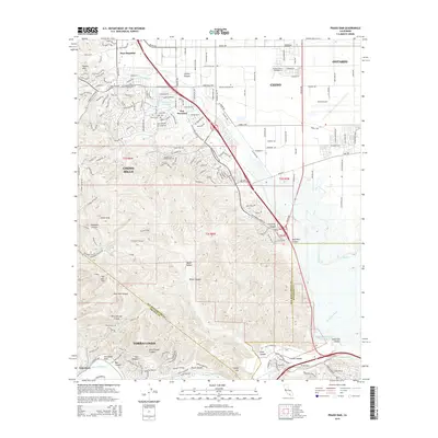
2015 Map of Prado Dam
USGS Topo · Published 2015About this map
The Prado Dam and its expansive Prado Flood Control Basin dominate the southern landscape of this 2015 study, marking the critical confluence where the Santa Ana River meets the canyon gaps. To the north, the suburban expansion of Chino and Ontario is evident, centered around the Chino Airport and the historic Boys Republic community. The topographic transition is sharp, moving from the flat alluvial plains of the Chino Creek drainage into the complex ridgelines of the Chino Hills. Here, numerous named canyons such as Telegraph Canyon and Banie Canyon carve into the uplands, leading toward San Juan Hill. The map also captures the residential clusters of Los Serranos around Lake los Serranos, illustrating the intersection of master-planned development and significant flood management infrastructure at the Riverside and San Bernardino county lines.
Find a feature on this map
50 named features on this map. Tap any name to fly to it.
Don’t see what you’re looking for? This feature index may not catch every label — zoom into the map to look around manually.
Map Details
Editions of this 2015 Prado Dam Map
This is the sole edition of this map. No revisions or reprints were ever made.
Other maps of this area

1894 · Pomona
USGS Topo · 1:62,500

1896 · Anaheim
USGS Topo · 1:62,500

1897 · Pomona
USGS Topo · 1:62,500

1897 · Cucamonga
USGS Topo · 1:62,500

1898 · Pomona
USGS Topo · 1:62,500

1898 · Anaheim
USGS Topo · 1:62,500

1900 · Cucamonga
USGS Topo · 1:62,500

1901 · Southern California Sheet No. 1
USGS Topo · 1:250,000

1901 · Anaheim
USGS Topo · 1:62,500

1902 · Corona
USGS Topo · 1:125,000