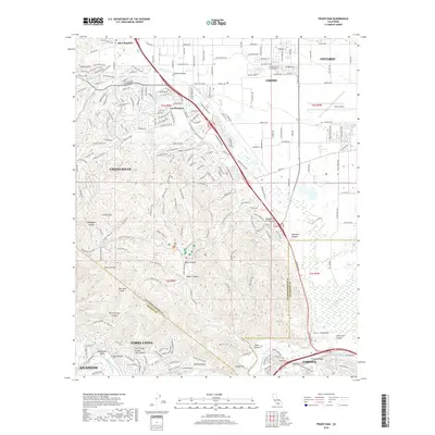
2018 Map of Prado Dam
USGS Topo · Published 2018About this map
Prado Dam and the Santa Ana River serve as the geographic anchor for this region where San Bernardino, Riverside, and Orange counties converge. The landscape is defined by the sharp transition from the residential and industrial growth of Ontario, Chino, and Corona into the preserved open space of Chino Hills. In the north, the community of Los Serranos and the private school Boys Republic sit near the edge of the more developed Chino basin.
Find a feature on this map
210 named features on this map. Tap any name to fly to it.
Don’t see what you’re looking for? This feature index may not catch every label — zoom into the map to look around manually.
Map Details
Editions of this 2018 Prado Dam Map
This is the sole edition of this map. No revisions or reprints were ever made.
Other maps of this area

1894 · Pomona
USGS Topo · 1:62,500

1896 · Anaheim
USGS Topo · 1:62,500

1897 · Pomona
USGS Topo · 1:62,500

1897 · Cucamonga
USGS Topo · 1:62,500

1898 · Pomona
USGS Topo · 1:62,500

1898 · Anaheim
USGS Topo · 1:62,500

1900 · Cucamonga
USGS Topo · 1:62,500

1901 · Southern California Sheet No. 1
USGS Topo · 1:250,000

1901 · Anaheim
USGS Topo · 1:62,500

1902 · Corona
USGS Topo · 1:125,000