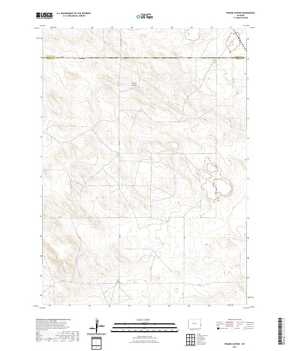
2021 Map of Prairie Center
USGS Topo · Published 2021About this map
Prairie Center serves as the primary landmark in this rural expanse along the high plains of eastern Wyoming. Situated near the southern edge of the map, the small settlement anchors a network of section-line roads that define the region's agricultural layout, including Rd 18 and Rd 51. The landscape is characterized by the gentle drainage of Nichols Canyon in the north and the prominent east-west boundary between Niobrara County and Goshen County. The mapping of townships such as t30n r61w reveals the systematic Public Land Survey System grid that organized this corner of the state for ranching and homesteading. Travelers and local researchers can trace the connectivity provided by Co Rd 6 along the northern county line and McMaster Rd, which cuts through the northern sections towards the canyon breaks.
Find a feature on this map
19 named features on this map. Tap any name to fly to it.
Don’t see what you’re looking for? This feature index may not catch every label — zoom into the map to look around manually.
Map Details
Editions of this 2021 Prairie Center Map
This is the sole edition of this map. No revisions or reprints were ever made.
Other maps of this area

1896 · Patrick
USGS Topo · 1:125,000

1954 · Torrington
USGS Topo · 1:250,000

1958 · Torrington
USGS Topo · 1:250,000

1974 · Mc Master Reservoir
USGS Topo · 1:24,000

1974 · Jay Em
USGS Topo · 1:24,000

1977 · Hileman Draw
USGS Topo · 1:24,000

1977 · Van Tassell
USGS Topo · 1:24,000

1977 · Van Tassell SE
USGS Topo · 1:24,000

1977 · Prairie Center
USGS Topo · 1:24,000
1977 · Spoon Butte NW
USGS Topo · 1:24,000