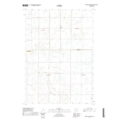
2017 Map of Prairie Center School
USGS Topo · Published 2017About this map
Winnebago Valley dominates the northern half of this landscape, where the terrain shifts toward the drainage basin of Elm Creek. In the southern portion of the quadrangle, the namesake Prairie Center School stands as a focal point for the rural community near the intersection of 224th St and Co Rd. The map illustrates the sparsely populated border between Hand and Buffalo counties, defined by a grid of section lines and gravel roads such as Ree Heights Rd. This 2017 survey reflects the persistent agricultural character of the region, where legacy landmarks like the Elm Creek Cem remain preserved alongside the section-line roads 222nd St and Valley Rd. The distribution of wetlands and intermittent water features across the high plains highlights the environmental constraints that have shaped local land use and road networks since the original township surveys.
Find a feature on this map
24 named features on this map. Tap any name to fly to it.
Don’t see what you’re looking for? This feature index may not catch every label — zoom into the map to look around manually.
Map Details
Editions of this 2017 Prairie Center School Map
This is the sole edition of this map. No revisions or reprints were ever made.
Other maps of this area

1953 · Huron
USGS Topo · 1:250,000

1954 · Huron
USGS Topo · 1:250,000

1966 · Big Bend Dam NE
USGS Topo · 1:24,000

1966 · Big Bend Dam SE
USGS Topo · 1:24,000

1973 · Big Bend Dam 4 SE
USGS Topo · 1:24,000

1973 · Ames
USGS Topo · 1:24,000

1973 · Miller Dale Colony SW
USGS Topo · 1:24,000

1973 · Big Bend Dam 4 NW
USGS Topo · 1:24,000

1973 · Macs Corner SE
USGS Topo · 1:24,000

1973 · Big Bend Dam 4 NE
USGS Topo · 1:24,000