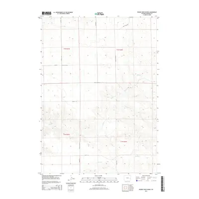
2015 Map of Prairie View School
USGS Topo · Published 2015About this map
Prairie View School serves as a lone landmark in this portion of Niobrara County, situated among a network of rural routes that facilitate movement through the high plains. The landscape is defined by the drainage systems of Muddy Cr and its tributary, Little Muddy Cr, which carve through the terrain alongside Spanish Cr. This map details the intersection of local history and geology, particularly through the presence of Spanish Diggings Rd, a name that references the significant prehistoric stone quarries found in the region. The road network, including Windmill Rd, Baars Rd, and Flatop Rd, reflects the expansive ranching and land-management patterns of eastern Wyoming in the early 21st century.
Find a feature on this map
14 named features on this map. Tap any name to fly to it.
Don’t see what you’re looking for? This feature index may not catch every label — zoom into the map to look around manually.
Map Details
Editions of this 2015 Prairie View School Map
This is the sole edition of this map. No revisions or reprints were ever made.
Other maps of this area

1949 · Cedar Top
USGS Topo · 1:24,000

1950 · Amend Ranch
USGS Topo · 1:24,000

1950 · Cedar Top
USGS Topo · 1:24,000

1950 · Prairie View School
USGS Topo · 1:24,000

1950 · Jewel Springs
USGS Topo · 1:24,000

1954 · Torrington
USGS Topo · 1:250,000

1958 · Torrington
USGS Topo · 1:250,000
1961 · Jewel Springs
USGS Topo · 1:24,000

1970 · Lost Springs
USGS Topo · 1:24,000

1970 · Keeline
USGS Topo · 1:24,000