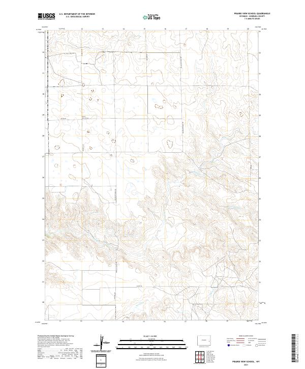
2021 Map of Prairie View School
USGS Topo · Published 2021About this map
Prairie View School stands as a focal point in this portion of Niobrara County, anchoring a landscape defined by expansive ranching plots and a network of named local thoroughfares. The drainage patterns of the high plains are clearly delineated by the winding courses of Muddy Cr, Little Muddy Cr, and Spanish Cr, which cut through the undulating terrain. A sense of the region's historical and contemporary land use is evident in the road names, from the utility of Windmill Rd and Flatop Rd to the more specialized Spanish Diggings Rd. This 2021 update of the township and range system (T32N R67W, T32N R66W, T31N R67W, and T31N R66W) provides an intricate view of property boundaries and local infrastructure in this sparsely populated corner of eastern Wyoming.
Find a feature on this map
14 named features on this map. Tap any name to fly to it.
Don’t see what you’re looking for? This feature index may not catch every label — zoom into the map to look around manually.
Map Details
Editions of this 2021 Prairie View School Map
This is the sole edition of this map. No revisions or reprints were ever made.
Other maps of this area

1949 · Cedar Top
USGS Topo · 1:24,000

1950 · Amend Ranch
USGS Topo · 1:24,000

1950 · Cedar Top
USGS Topo · 1:24,000

1950 · Prairie View School
USGS Topo · 1:24,000

1950 · Jewel Springs
USGS Topo · 1:24,000

1954 · Torrington
USGS Topo · 1:250,000

1958 · Torrington
USGS Topo · 1:250,000
1961 · Jewel Springs
USGS Topo · 1:24,000

1970 · Lost Springs
USGS Topo · 1:24,000

1970 · Keeline
USGS Topo · 1:24,000