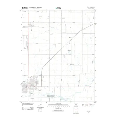
2012 Map of Pratt
USGS Topo · Published 2012About this map
The S Fork Ninnescah River anchors this Kansas landscape, flowing past the Pratt Fish Hatchery and Pratt County Lake. The city of Pratt serves as a regional hub, home to Pratt Community Coll and the Pratt County Fairgrounds. To the north, the small community of Iuka is surrounded by the Iuka-Carmi Oil and Gas Field, illustrating the area's dual reliance on agriculture and energy extraction.
Find a feature on this map
63 named features on this map. Tap any name to fly to it.
Don’t see what you’re looking for? This feature index may not catch every label — zoom into the map to look around manually.
Map Details
Editions of this 2012 Pratt Map
This is the sole edition of this map. No revisions or reprints were ever made.
Other maps of this area

1892 · Pratt
USGS Topo · 1:125,000

1894 · Pratt
USGS Topo · 1:125,000

1955 · Pratt
USGS Topo · 1:250,000

1959 · Pratt
USGS Topo · 1:250,000

1967 · Cairo
USGS Topo · 1:24,000

1968 · Pratt SW
USGS Topo · 1:24,000

1968 · Pratt
USGS Topo · 1:24,000

1968 · Coats
USGS Topo · 1:24,000

1968 · Coats NE
USGS Topo · 1:24,000
1968 · Pratt SE
USGS Topo · 1:24,000