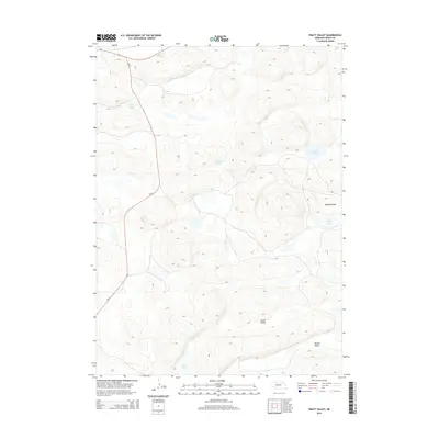
2014 Map of Pratt Valley
USGS Topo · Published 2014About this map
The Nebraska Sandhills define this landscape in Grant County, where the 2014 survey reveals a terrain of undulating dunes and scattered interdunal basins. Pratt Valley and Winnie Valley dominate the southeastern portion of the sheet, illustrating the region's characteristic longitudinal drainage patterns. Water is a defining element of this environment, with significant bodies like Long Lake and Muskrat Lake filling low-lying depressions. The intersection of Ne-2 and Ne-61 provides the primary infrastructure for this ranching-oriented geography. This map captures the natural complexity of the High Plains, where depressions such as Round Valley and the waters of Scotty Lake and Negro Lake are essential landmarks in a region largely defined by its topography rather than dense human settlement.
Find a feature on this map
10 named features on this map. Tap any name to fly to it.
Don’t see what you’re looking for? This feature index may not catch every label — zoom into the map to look around manually.
Map Details
Editions of this 2014 Pratt Valley Map
This is the sole edition of this map. No revisions or reprints were ever made.
Other maps of this area

1948 · Ashby
USGS Topo · 1:62,500

1948 · George Lake
USGS Topo · 1:62,500

1948 · Whitman
USGS Topo · 1:62,500

1948 · Spring Valley
USGS Topo · 1:62,500

1949 · Ashby
USGS Topo · 1:62,500

1950 · Spring Valley
USGS Topo · 1:62,500

1950 · Whitman
USGS Topo · 1:62,500

1950 · George Lake
USGS Topo · 1:62,500

1954 · North Platte
USGS Topo · 1:250,000

1956 · North Platte
USGS Topo · 1:250,000